

The Geology and Topography of Coombe Wood, and the Climatic Environment
Much of the information on the geology and climate of the wood is found in the book by Oliver Rackham: The Ancient Woodlands of England: The Woods of South-East Essex, published in 1986 by Rochford Borough Council.
Rackham describes the topography as “sloping down from a plateau in the south to the valley of a stream along the NW boundary. Within the wood is a second (very steep) valley – almost a ravine.” Although the stream in the north-west carries water most – if not all – of the year, the stream from the pond is very seasonal and will depend on the recent rainfall.
This description does not encompass the woodland to the north-west of the stream, which is part of the current woodland.
To the casual visitor seeing the wood from the Bread and Cheese Hill, this slope is very obvious. However, it does not describe the distinct mound – known as Coombe Kop – close to the southern boundary, with steep slopes up to it from the lower, western parts.
These lower parts are underlain by London Clay (deposited around 60–70 million years ago). The upper parts are underlain by the Claygate Beds (alternating strata of sands and clays) lying on top of the London Clay. The whole area was subsequently covered by a dense layer of loesse in the late ice age. It is this loesse which largely determines the soil of much of the wood.The Topography and Streams of the Wood
The main surface features of the wood are determined by the slope. This slope can clearly be seen along the southern boundary, by the London Road (A13). The lowest parts on this boundary are at the south-western corner, at the junction with Rhoda Road Northeast at around 47m above sea level. The road slopes up to around 75m at the eastern edge of the wood.
Walking along this southern boundary from Rhoda Road, the slope is at first gentle (around one in thirteen) but, once past the ride, it becomes steeper (around one in ten). Beyond Hillrest, the house about half way up, the slope becomes less until it flattens out just beyond the wood.
 The main road here appears to be in a
cutting, with elevated banks on each side.
The main road here appears to be in a
cutting, with elevated banks on each side.
by Kop
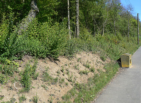
 The roadside here, below the Kop, varies in
steepness. The bare earth appears sandier than in most of the wood.
The roadside here, below the Kop, varies in
steepness. The bare earth appears sandier than in most of the wood.
by Hillrest
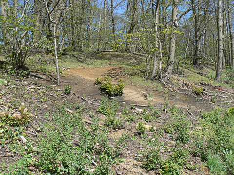
 The roadside here is flat, with a path
leading into the wood.
The roadside here is flat, with a path
leading into the wood.
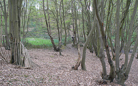
near Top
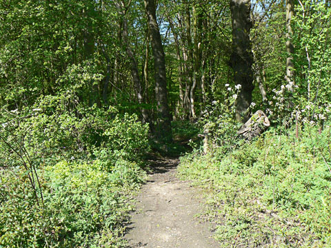
 From near the top of the hill, the ground
slopes steeply down into Bluebell Dell, covered in Blubells in the Spring.
From near the top of the hill, the ground
slopes steeply down into Bluebell Dell, covered in Blubells in the Spring.
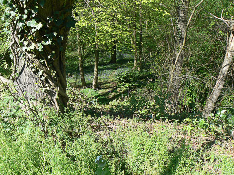
 This image looks across the valley and pond
from near the Lake Drive entrance. The London Road is on the far side, with
the slope rising from the pond (on the left) to the road.
This image looks across the valley and pond
from near the Lake Drive entrance. The London Road is on the far side, with
the slope rising from the pond (on the left) to the road.
small Stream
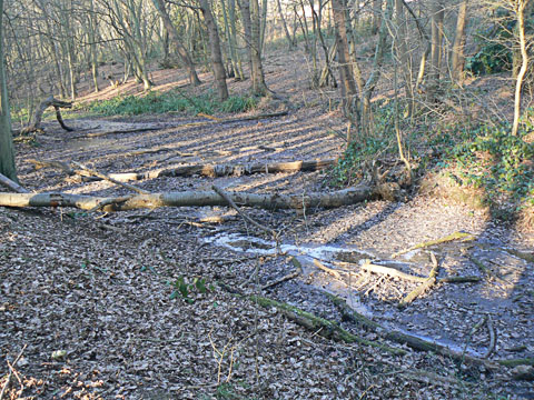 At the head of the valley, this is just
one of several small streams flowing into the pond. They vary in their flow
following the recent rainfall. This was taken in February, after much rain
had fallen.
At the head of the valley, this is just
one of several small streams flowing into the pond. They vary in their flow
following the recent rainfall. This was taken in February, after much rain
had fallen.
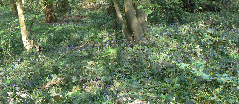
This is the floor of the valley known as Bluebell Dell because of the rich sward of Bluebells in late April and early May.
From the pond, a stream flows westwards, with relatively gentle slopes on either side except for the northern flank of Coombe Kop. As it crosses the main ride, the stream is partially dammed so that there is a marshy area just upstream from this. The stream flows underneath the ride (through a pipe) and then flows down to join the main stream, again with only gentle slopes either side. This stream is not a permanent feature. In a dry season, especially in suummer, it dries out.
The main stream flows from the north of the wood, south-westerly until it enters a culvert before reaching Rhoda Road North. The eastern side of the stream has a gentle slope, but the western side is steeper. This stream is permanent, and for much of its length flows in a steep-sided gully up to a metre or more deep. As it approaches Rhoda Road North, the gully opens out, and here the stream will flood after wet weather.
There is another stream running along the wood boundary from near the Coombewood Drive entrance, flowing westward in a gully to join the main stream.